
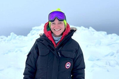
Editor's note: This is a first person account of Arctic research by Ellen Buckley, professor of Earth science and environmental change.
UTQIAQGVIK, Alaska — My boots crunch into the snow as I step onto the frozen Arctic Ocean. It’s April in Utqiaġvik, Alaska, and I’m here to help run a sea ice field trip for eighth graders and assist with some fieldwork. Around me, a network of tents — each with a story to tell about the sea ice — waits for the group of 13-year-olds to arrive.
I weave between snowmachines, stepping around gear arranged for the students. A Starlink device is behind me, keeping me tethered to my graduate student class via Zoom. These students are enrolled in my “Ice and the Climate System” course at the University of Illinois Urbana-Champaign, 3,000 miles away.
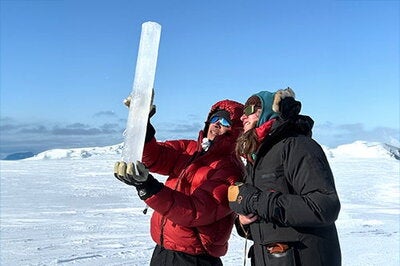
I hold up my phone, turning it to show my students back home what it looks like to drill an ice core, to scrape algae from the bottom of the ice, to lower a device that measures conductivity, temperature and depth into the ocean through a narrow hole.
The Zoom chat lights up:
“How thick is the ice?”
1-3 meters.
“How do you deal with polar bears?”
We have guards posted, scanning the horizon.
I pan to a group launching a kite used to map ice features and track traditional whaling routes. Another station shares Indigenous knowledge passed down over generations. Nearby, scientific instruments buzz in the cold.
The most popular stop for the younger students? The hot dog station, where the kids line up, laughing, cheeks red from the wind, for something warm off the grill. Science, ice and hot dogs — what more could you ask for?
I’m a remote sensing scientist by training. I’m used to interpreting sea ice through laser altimeters and satellite imagery. But this week, I’m teaching about ice while standing on it —snow blowing sideways, windchill biting. The middle school students are from the local community, bringing their lived knowledge of ice and cold. We trade terms: I describe freeboard — the height of floating ice above the sea surface — and melt ponds; they tell me about the celebrations that occur when a whale is brought ashore.
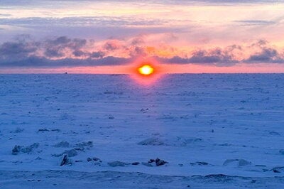
Later, back on land, I look out over the sea ice as the sun slowly sets. Soon, this ice will break away from the shore and move west. And from now on, when I see pixels from space, I’ll imagine boot prints, a whaling livelihood, polar bears and the faint sound of laughter across a white expanse.
The U.S. Interagency Arctic Buoy Program, the National Science Foundation, UIC Science and Batelle Arctic Research Operations supported this work. Readers can learn more about these programs at https://usiabp.apl.uw.edu/
Subscribe to Behind the Scenes for short blog posts, photos and videos from Illinois faculty, researchers, students and staff about their work and lives. Send an email with “SUBSCRIBE BTS” in the subject line.