“Exhausting, hard work, and muddy,” are the words atmospheric sciences graduate student Leanne Blind-Doskocil uses to describe the Propagation, Evolution, and Rotation in Linear Storms (PERiLS) campaign.
“But so worthwhile,” Blind-Doskocil added, recently.
Imagine one day you are chasing a tornado, and the next you are in class. That’s what it’s like for U of I atmospheric sciences professors, staff, and students taking part in the PERiLS campaign to help scientists to better understand the significance of thunderstorm squall lines in tornado formation. The field study is now in its second spring.
“PERiLS is a project that aims to better understand the processes that form tornadoes from storms called quasi linear convective systems, or QLCSs,” said Steve Nesbitt, a professor of atmospheric sciences. “These are storm systems that we experience sometimes in the Midwest and often produce tornadoes at night, but can produce tornadoes that have lower predictability from a forecasting standpoint.”
Added Jeff Trapp, head of the Department of Atmospheric Sciences, “We want to be able to develop some ideas and new knowledge and ultimately enhance operational tornado warnings that will address this problem.”
With their operations based out of Memphis, Tennessee, dozens of faculty, students, and other atmospheric researchers from the University of Illinois, North Carolina State University, and other universities and laboratories around the country are committing their time, expertise, and equipment to the campaign.
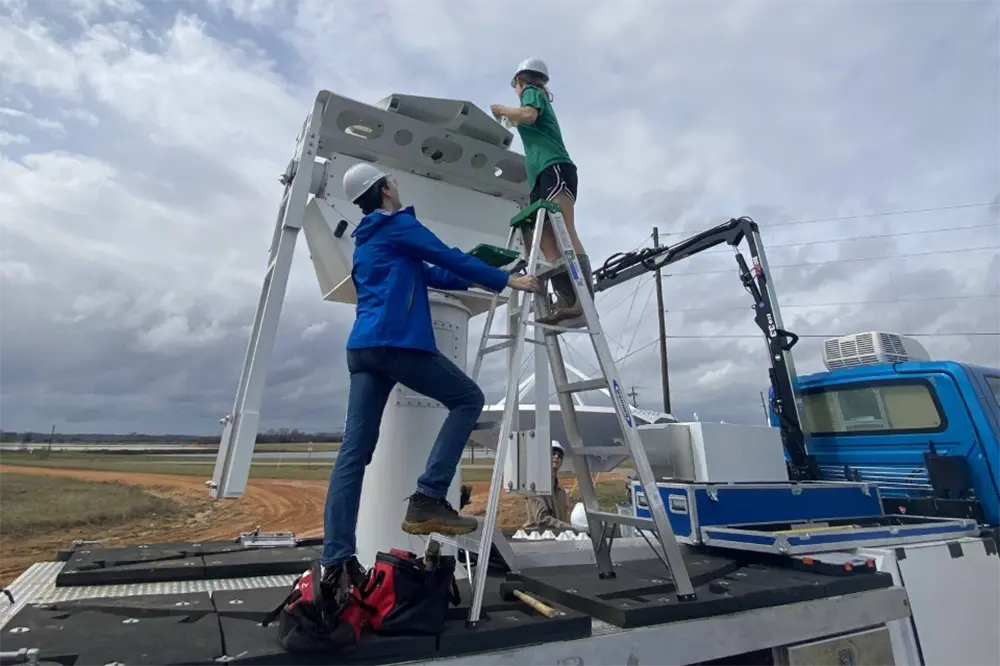
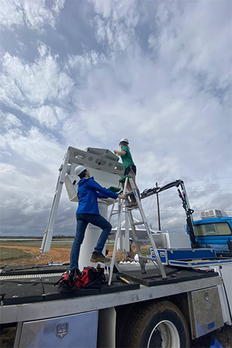
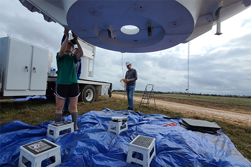
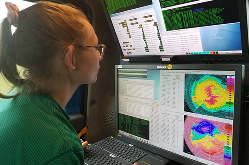
Karen Kosiba, managing director of the U of I Flexible Array of Radars and Mesonets (FARM) and adjunct research professor at Illinois and lead scientist in the PERiLS campaign, said that U of I faculty and staff are leading the scientific efforts, while students are getting real-world experience with field project planning, radar, profiler, weather balloon, and instrument operation, data collection, and data analysis.
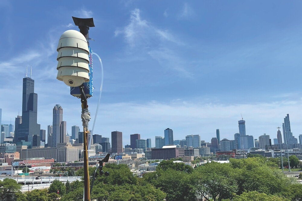
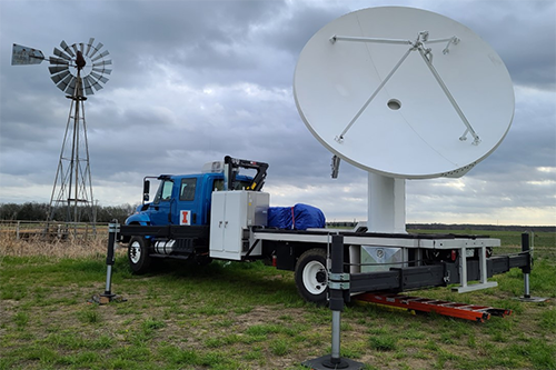
Joshua Wurman, executive director of the U of I FARM, and inventor of the Doppler On Wheels and other mobile instrumentation used in PERiLS, said that the mobile DOW radars, mesonets, tornado Pods, and other FARM instrumentation are especially useful for a project like PERiLs.
“We deploy these state-of-the-art radars and other instruments to different places for every mission,” he said, “allowing us to target tornadic storms and create uniquely fine-detailed 3D maps of winds, precipitation, and measure the thermodynamics, the temperatures and humidities of the air, that feed, that energize, these dangerous storms, sometime leading to tornadoes.”
With the second year of the campaign having started in early February, the researchers hope to gather at least double the amount of data collected last year. The campaign, however, has already provided some valuable scientific insight.
“One of the more compelling findings thus far is that the myriad of the thunderstorm-generated mesovortices—i.e. vortices that are much larger in scale than tornadoes—appear only to be in contact with the ground for relatively short periods of time,” Trapp said.
He added, “We have known for more than 20 years that these mesovortices exist and can cause wind damage as well as spawn tornadoes, but never before have we had the type of data to allow us to examine their near-ground structure in detail.”
Nesbitt said that they were able to observe four tornado-producing storms in 2022—they hope to observe at least eight this year. Each of last year’s events, he added, helped expand their understanding of the storms.
“Some of the cases featured very strong rotation near the surface prior to forming a tornado, which is expected based on our understanding of tornadogenesis (the process of forming a tornado),” he said.
Added Wurman: “PERiLS is designed to allow us to collect data that will help us and future forecasters better predict when and where QLCS tornadoes will form.”
Students have been essential to the campaign. According to Nesbitt, Blind-Doskocil captured unexpected data in an event where “a tornado from a circulation aloft in the storm with little visible circulation lower down in the storm prior to tornado formation.”
The scientists expect to have observation teams in the field at least once every week and a half. What exactly do these field days look like? For starters, they are often referred to as intensive observing periods, or IOPs, which consist of the teams going out to observe storms. The team does not begin an IOP until they spot an area of expected storm activity on the radar.
According to Trapp, this element of “uncertainty” can be difficult. “One of the challenges of this project is that we have to make decisions pretty far in advance. So we’re basically calling an operational period (about) four days before the expected day of the event.”
A typical IOP ranges from three to four days, with much of that time being spent driving. Being that a majority of the research is focused in the Southeastern U.S., it takes the team some extra time to get to the desired location.
“We’re driving to locations basically to Memphis and southward,” Trapp explains. After picking up instruments the team often spends another 4-6 hours in the car before arriving at the set location.
From there, Trapp shares how they let Mother Nature do her thing and wait until the storm unfolds. “Once we are there we tend to be fixed so we will collect data in a specific location over that period.”
While it may seem like a burden, the driving is actually a highlight for some students.
“You are driving a lot,” Blind-Doskocil said. “Each deployment averages about 20 hours of driving time. This makes getting to know the people in the car crucial to your sanity and enjoyment on the trip. It has been fun jamming to music, playing 20 questions, and learning about one another.”
While the idea of chasing a storm may seem dangerous, the teams take many safety precautions. The vehicles are equipped with real-time radar feeds and there is a lot of communication between groups. They have evacuation plans in case storms get too close.
“We have a really good sense of what’s going on in terms of weather and potentially hazardous weather,” Trapp said.
At the time of the storm, the teams split up and use various instruments to collect all sorts of data. Though team sizes vary, they often include up to 12 students. Trapp mixes up the groups so that more experienced students are partnered with newer ones. Student and professor schedules are also a factor.
Blind-Doskocil has been involved with the campaign since last spring, when she was able to attend three IOPs.
“I have helped operate the COW (C-band on Wheels) Doppler weather radar during the project,” she said. According to Wurman, The COW is their newest and most powerful and advanced radar. It can be assembled in a field in about two hours, with capabilities to collect uniquely penetrating and sharp data on QLCS and tornadoes.
While learning to work with the instruments can be rewarding, Blind-Doskocil has also enjoyed the sense of community surrounding the campaign.
“Getting to meet a variety of different people with similar passions to mine has been by far my favorite part,” she said. “I didn't realize how close I would become with some of the other scientists on the project. We work hard to collect the best data possible, work through problems encountered along the way, and celebrate victories together.”
Blind-Doskocil has also appreciated the interactions with people who are curious about the campaign.
“People often stop by in awe of the radar, and they are very interested in learning about the project,” she said. “We share tornado shelter locations and severe weather safety tips with them while they share their severe weather stories and local knowledge with us.”
Eddie Wolff, another atmospheric sciences graduate student involved in the campaign, also enjoys the social aspect.
“It’s been a lot of fun to explore these new places with the other students and our professors,” Wolff said. “The stories of restaurants we visited and conversations we had on last year’s trips are things we still talk about today.”
The PERiLS campaign, he added, has been a success academically as well.
“Being able to put the skills you learn in the classroom into practice is an invaluable thing,” Wolff said. “It’s one thing to learn how radar works, but it’s entirely different to sit behind the computer and actually operate one out in the field. It also gives you a much greater appreciation for all of the data and discoveries we might otherwise take for granted but that, in reality, are the result of so much hard work.”
While the team is currently in the field phase of the campaign, Kosiba added that “once the field phase ends, the real work begins.”
She expects the analysis of the data collected in the field to span across a few years. When the analysis is complete, the information collected now has the potential to improve the predictability of dangerous storms.
Said Kosiba, "These datasets will be incredibly valuable for increasing our knowledge of QLCS tornadoes.”